/eh/2025-01-08/173633966714069467/picture.png)

/eh/2024-12-24/173503345348979036/Favorite-Icon.png)
/eh/2025-07-08/1751962110204480194/picture.png)
/eh/2025-06-21/1750485478958537574/countryInfoIcon.png)
/eh/2025-06-21/1750485741321434291/Hi-Sign-in-My-Nihao.png)
/eh/2025-06-21/1750485837193896318/cart.png)
/eh/2025-06-21/1750485968202533847/cart.png)
/eh/2025-04-17/1744862476612819675/hot-img.png)
/eh/2025-11-07/1762504524550532584/header-icon.jpg)
/eh/2025-07-07/1751875582852206790/header-icon.png)
/eh/2025-07-07/1751875587886277738/header-icon.png)

Best in 7 days


Shopping security
Get advanced outdoor features — plus inReach technology for two-way messaging and interactive SOS alerts — in a rugged 5-inch format that’s ideal for navigation on foot, bike, kayak, ATV and more.
 LARGE 5-INCH GLOVE-FRIENDLY TOUCHSCREEN
 ROUTABLE TOPOGRAPHIC MAPS WITH LANDMARKS
 TRIGGER AN INTERACTIVE SOS WITH OUR 24/7 GLOBAL COORDINATION CENTER1
 MEETS MIL-STD 810 FOR THERMAL, SHOCK, WATER AND VIBRATION
 SATELLITE IMAGERY SHOWS VIVID OVERHEAD VIEWS OF YOUR ROUTE
 SUPPORTS OUTDOOR MAPS+ FOR PREMIUM MAPPING (SOLD SEPARATELY)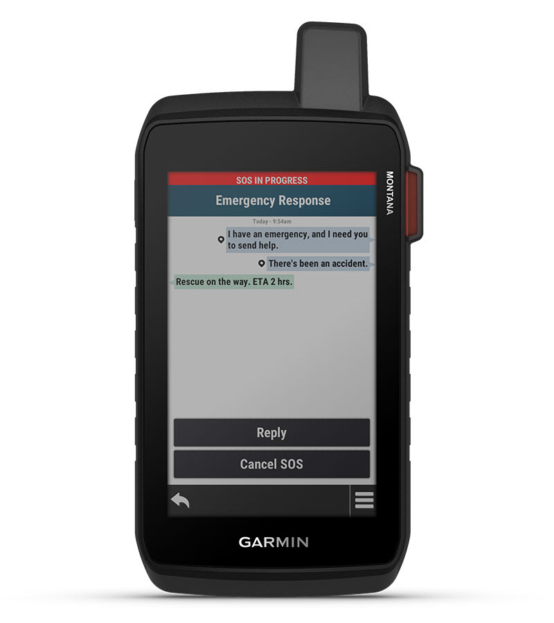
With an active inReach subscription, you can stay connected even when your adventures go off grid. Instead of relying on cellphone coverage, now your messages, SOS and tracking are transferred via the 100% global Iridium satellite network.
This durable, water-resistant handheld is tested to meet MIL-STD 810 for thermal, shock, water and vibration. It features a glove-friendly 5-inch touchscreen and is compatible with a variety of robust mounting solutions (sold separately) to best suit your activities.
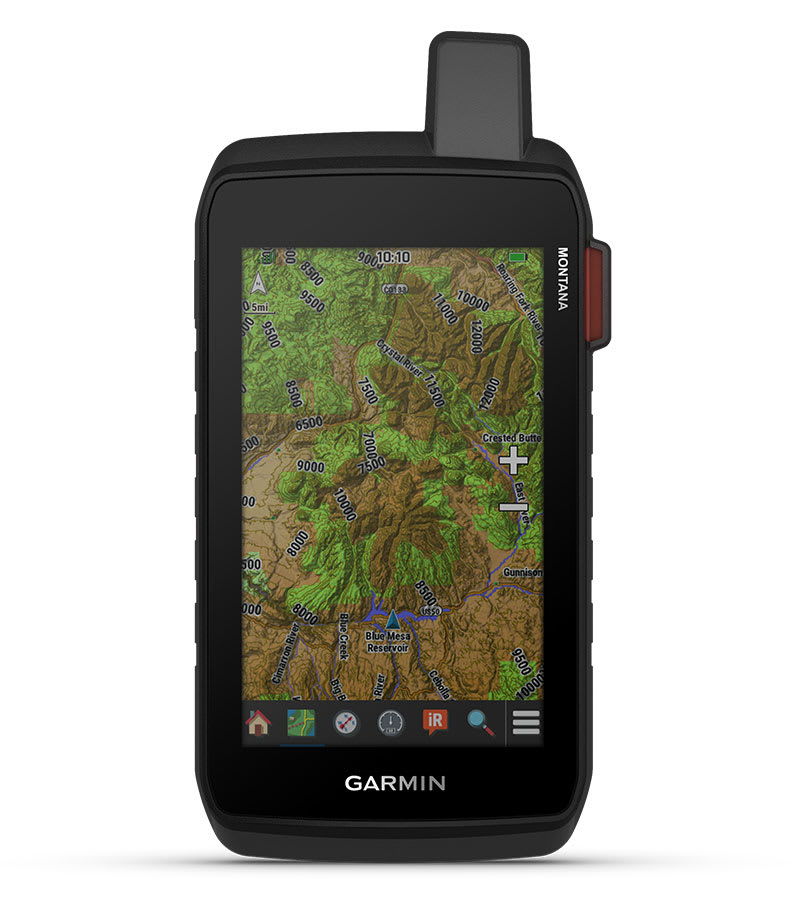
To navigate your adventures, use preloaded worldwide topographical maps. View terrain contours, elevations, coastlines, rivers, landmarks and more.
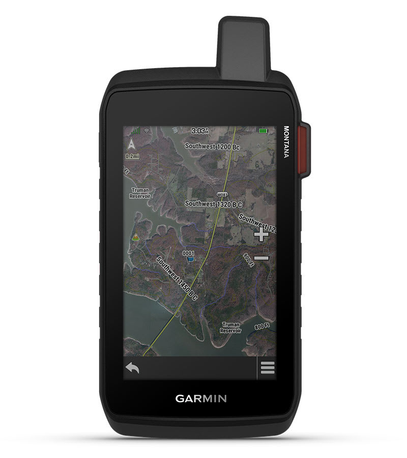
Access subscription-free, high-resolution satellite imagery with direct-to-device downloads over Wi-Fi connectivity. See photorealistic overhead views of routes and surrounding terrain, and easily create waypoints based on landmarks.
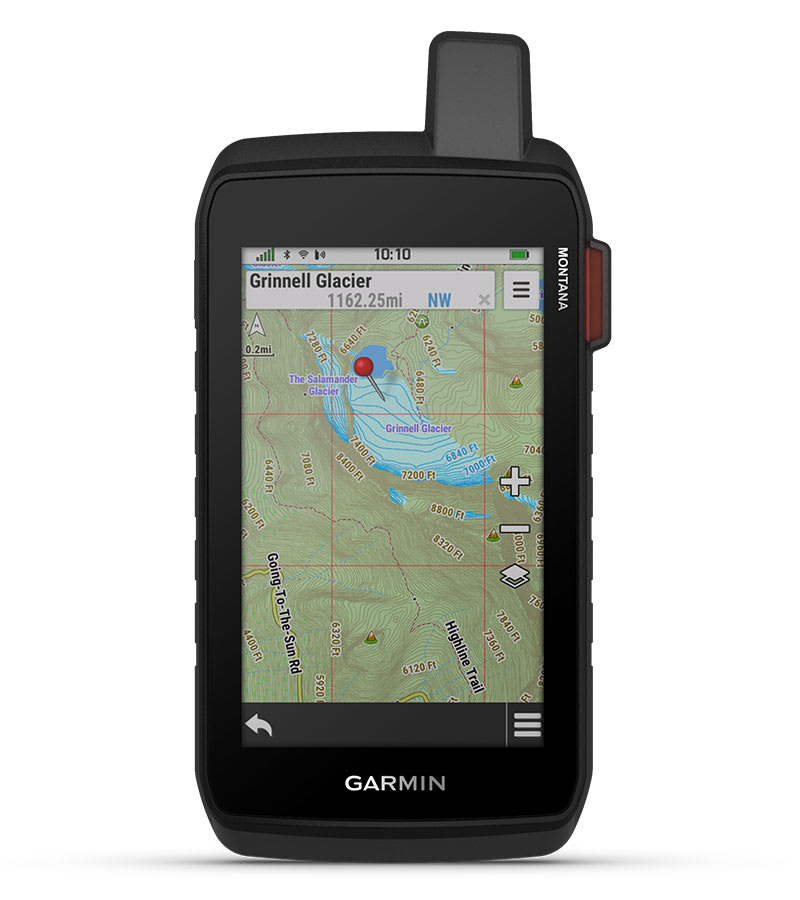
Add a subscription to Outdoor Maps+ (sold separately), and get ongoing access to a wide variety of premium mapping content and regular updates sent right to your Garmin device via Wi-Fi technology.
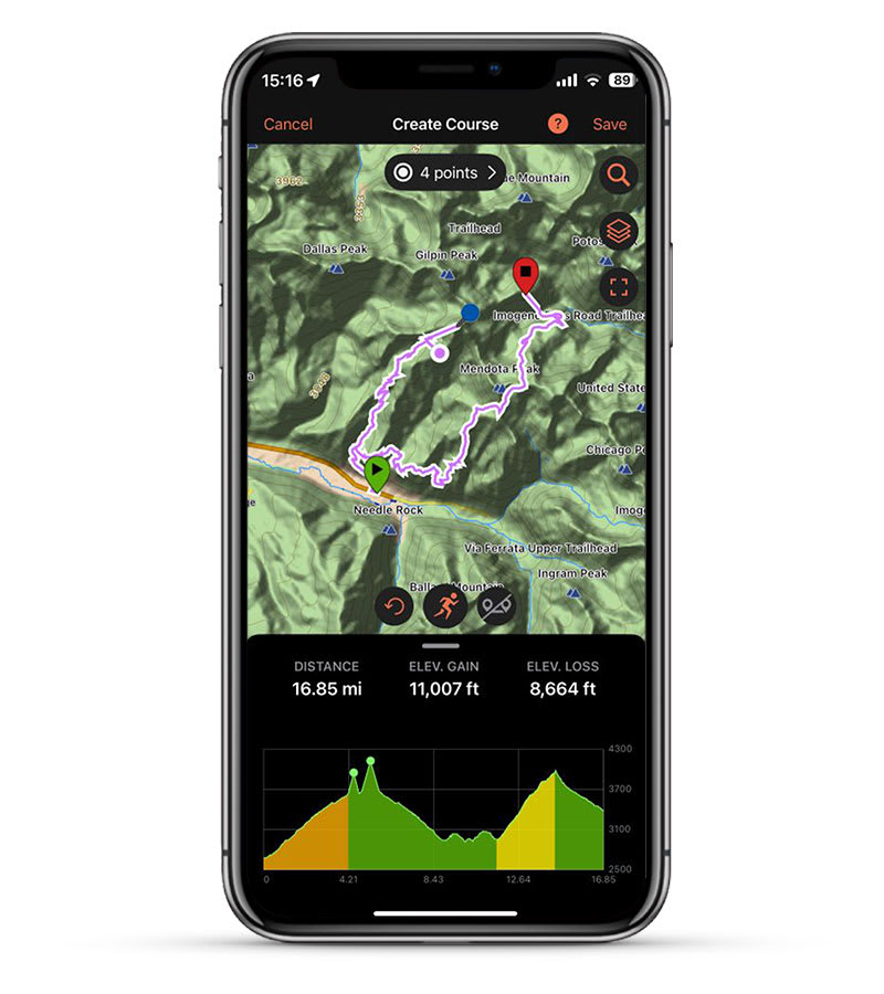
Pair with the Garmin Explore app to plan and review trip data, plus manage your waypoints, courses and activities.

Exchange text messages with loved ones back home, or communicate via inReach device to inReach device in the field.
In case of emergency, trigger an interactive SOS message to Garmin Response, a 24/7-staffed professional emergency response coordination center.

Available inReach weather forecast service provides detailed updates directly to your Montana handheld or paired devices, so you’ll know what to expect en route.

Using your live tracking page, followers can see your progress, ping your device to see your GPS location and exchange messages during your trip.

Access to GPS and Galileo satellite networks enables Montana 710i to track in more challenging environments than GPS alone.

Navigate your next trail with ABC sensors, including an altimeter for elevation data, barometer to monitor weather and 3-axis electronic compass.

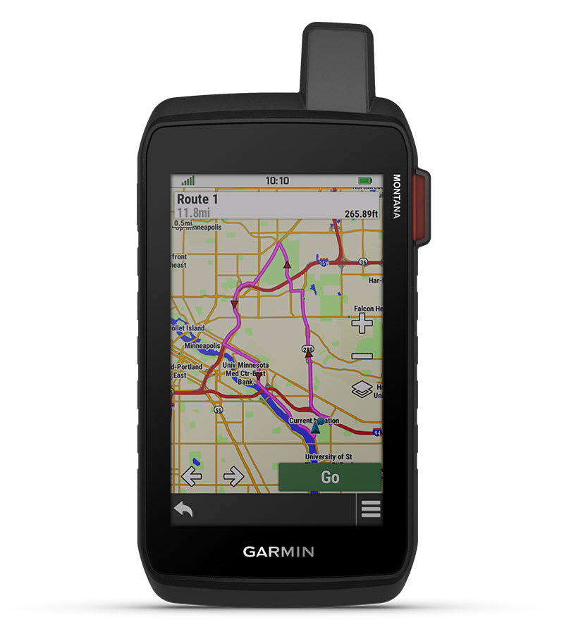
Seamlessly transition from trails to road navigation with preloaded City Navigator street mapping, which guides your drive with easy-to-follow turn-by-turn directions.

With 32 GB of onboard memory, you can download even more maps, such as BlueChart g3 charts for the water (sold separately).

Access up-to-date active weather forecasts via the Garmin Connect app on your compatible smartphone.

For hunters and trainers, this Montana handheld syncs with your compatible Astro or Alpha series handhelds to help track sporting dogs in the field.

This preloaded app lets you easily download hiking, cycling and other Wikiloc trails shared by outdoor enthusiasts like you. Get a free 60-day Wikiloc Premium trial to try this and other exclusive features.

Trek far and wide off-grid. Use expedition mode, an ultralow-powered GPS reference, to keep Montana tracking for more than 2 weeks between recharges.

An internal lithium-ion battery pack provides up to 24 hours of battery life in GPS mode and recharges with a standard USB-C cable.

A variety of Montana handheld-compatible mounts (sold separately) lets you adapt your navigator for use on ATVs, boats, cars, motorcycles, RVs or other vehicles.

Ships within 48 hours · Estimated delivery Jul 11 - Jul 16
US$40
Get nowSign up to your membership to get coupons up to
15%
Get nowOpportunity to enjoy order discount up to 15% off
Top-Converting Item to Boost Your Average Order


